The Golden Road is a 7 mile hike across the entire range of the Preseli Hills in Pembrokeshire.
It’s where the Bluestones at Stonehenge are believed to be from and the route takes you through some of the most likely sites.
Although Archaeologists aren’t certain of the origins or purpose of the Golden Road, that it is, and was, of huge historical significance is not in doubt.
The road itself may date back to 3,000 BC and the transportation of the stones possibly 4,000 years.
One school of thought is that it was part of a trade route from Ireland through to South East England, and we can definitely see how that would make sense. You can see the Wicklow mountains from here on a good day and the Golden Road lines up pretty well with it.
It’s a hugely atmospheric place, maybe because it was once so full of life, but you’ll probably be able to count on two hands the number of people you see here even on a ‘busy’ day.
One of the great things about ridge walks like this one is that once you’re up you’re up and the Preseli Hills Golden road is no exception. What’s even better here is the car park is up, so, if you do it in the direction described below there’s not a huge amount of ascent. There’s some, but it’s not like a hike to the top before you start.
You can just drive there!
How to get to The Preseli Hills Golden Road
As you’ll be starting the Preseli Hills Golden Road walk from the same car park as Foel Eryr the directions are also the same.
From the North
Take the A487 to Cardigan and stay on it towards Newport.
Just after passing through the village of Eglwyswrw, and just after the Dyfed Shire Horse Farm, turn left on to the B4329.
Continue through the villages of Crosswell and Brynberian and you will eventually pass over a cattle grid.
When you reach the highest point on this road, you will see the relatively large parking area on your left.
From the South or East
Take the A40 towards Narberth.
At the main Penblewyn Roundabout take the A478 sign-posted Cardigan.
At the next crossroads (before Clunderwen) take a left onto the B4313 towards Maenclochog.
Stay on this road until you reach a junction at the village of Maenclochog.
At this junction turn right and drive slowly through the village towards Rosebush
Continue on this road until you get to the New Inn/Tafarn Newydd crossroads.
At this cross-roads turn right up the hill
over a cattle grid, and
when you reach the highest point of the road you will find the parking area on your right.
From the West
From the A40 take the B4329 heading towards Rosebush.
At New Inn/Tafarn Newydd crossroads proceed straight ahead towards Cardigan.
You will pass over a cattle grid and,
when you reach the highest point on the road you will find the parking area on your right.
Where to park for The Preseli Hills Golden Road
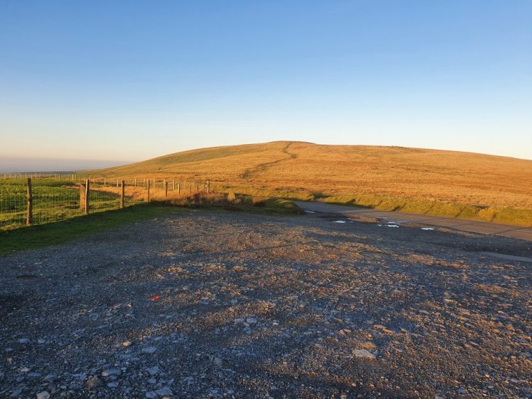
Parking for the start of the Golden Road is at Bwlch Gwynt, between Tafarn y Bwlch and Tufton, at the summit of the B4329. You can also walk to Foel Cwmcerwyn and Foel Eryr from here.
Starting at the Bwlch Gwynt car park head East. These are the kinds of views you can expect as you leave the car park behind.
Sections of the path here are cobbled and it’s uphill for the first quarter of a mile or so before it starts to level off and then descend.
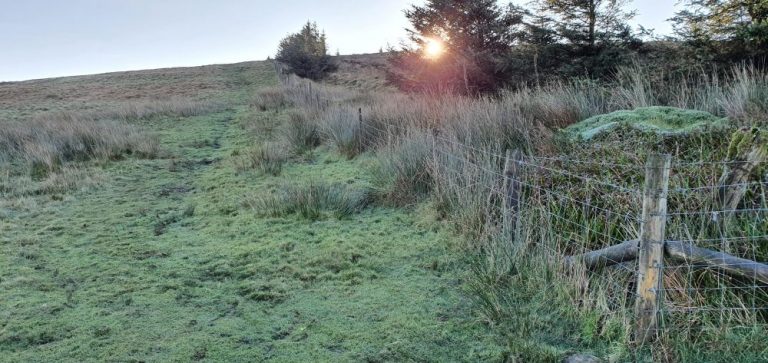
This next section really is very wet and boggy but the views are pretty special.
Your best bet is either to follow the fence around to the right or avoid as much of the wet stuff by skirting around it to your left. You’ll really need to pick your way through here watching your footing and making a few well timed jumps.
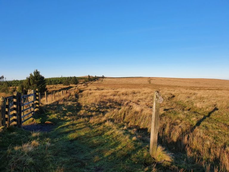
You’ll pass this gate and marker just as the path starts to gently ascend again.
Just up ahead, about a mile into the walk along, the fence takes a 90 degree turn to the right. Do not follow the fence if you are only walking the Golden Road. Continue Eastwards along the path which is now at right angles to the fence. If you do want to head up to the highest peak in the Preselis, Foel Cwm Cerwyn, this is where you need to branch off by following the fence up to the right.
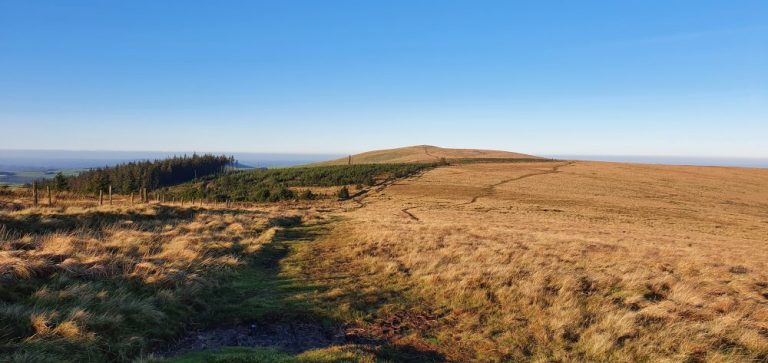
Foel Feddau
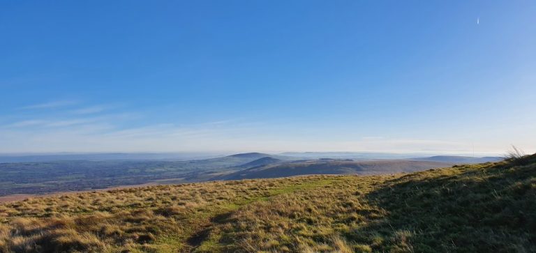
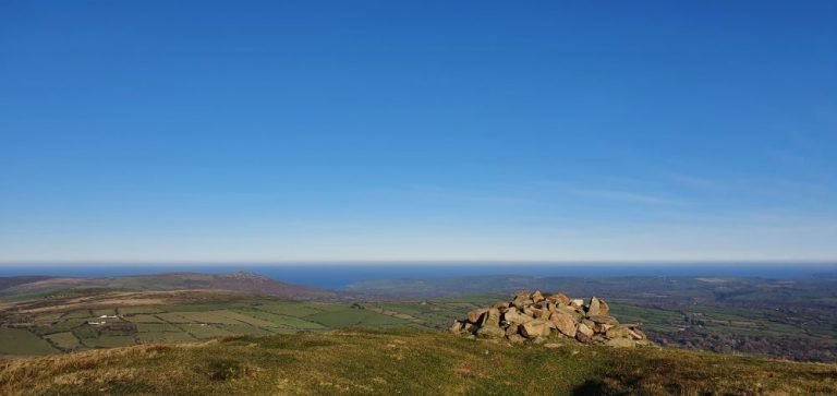
After just under 2 miles you reach the Bronze age burial cairn at Foel Feddau. At 467m this is the highest point of the Preseli Hills Golden Road and the views from here are stunning.
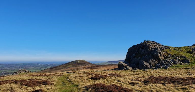
From Feddau you’ll enjoy a steady descent and at about 2.4 miles is this rocky outcrop on the right hand side. Some of the stones here resemble giant teeth and we can’t help thinking about Stonehenge when in this stone circle. It’s an awesome place in the truest sense of the word.
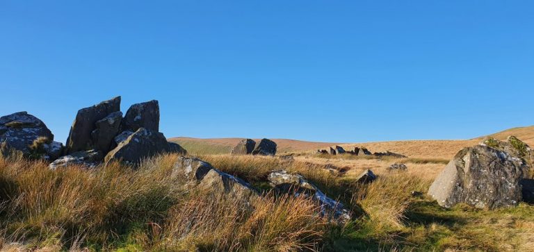
Carn Bica
At around 4 miles you’ll arrive at Carn Bica on your left hand side. Slightly off the path, the rocks here are huge and if you’re anything like us you’ll find yourself drawn to them. Go and explore, it’s well worth it. From here you get a great view of Carn Menyn with Bedd Arthur in the foreground.
You can pass through Bedd Arthur, which legend claims to be the last resting place of King Arthur and his knights. Before heading down towards Carn Menyn.
Carn Menyn
After about 5 miles you come to Carn Menyn on your right hand side. It’s worth the slight detour off the Golden Road path to walk through what is currently believed to be the legendary source of the Bluestones at Stonehenge. It’s easy to believe that when you’re here, not least because it looks and feels like an ancient quarry. You also get a great view of your ultimate destination on this walk – Foel Drygarn.
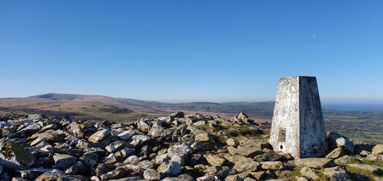
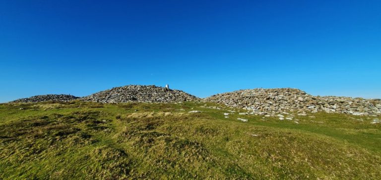
Foel Drygarn
It’s more or less a mile from Carn Menyn to Foel Drygarn and if it’s not too windy you’ll probably want to spend a bit of time here.
For us, this is probably the highlight of the walk. Possibly because we’ve (almost) reached the end but more likely because this place is fascinating. An incredible ‘live’ example of a Hill Fort it’s summit plateau is adorned with three Bronze Age burial cairns and a Trig point. What more could you want?
When doing the Golden Road we can’t help thinking about the many people who would have been walking this route or even living up here over the centuries. There’s something surreal about having this place to yourself when, at one time in the past, it would have been so busy and full of people.
The Preseli Hills Golden Road is not waymarked and It’s definitely possible to lose your way. So make sure you’re properly geared up even on a good day and at the very least take a compass and this map for navigation.
There are no two ways about it, you will get wet here. This place is good at retaining water even in Summer. Sometimes lots of it! You’ll need your very best waterproof boots here and, even then, your feet may not stay dry.
Make no mistake, this is a tough walk. 7 miles yes. But it can take a lot longer than any other 7 mile hike we’ve done.
It’s well worth it though.
Facilities
There are no facilities here so be prepared. The nearby village of Maenclochog has:
Public Conveniences
A well stocked shop
Petrol Stations, and
A really good Cafe
In Rosebush there is a Public House serving lunch and dinner.
If you are visiting Pembrokeshire now or in the near future please be aware that social distancing rules still apply in Wales. Please keep yourselves and others safe.
You’re blessed with access to so many beautiful hiking trails. A lot of your shots remind me of my teens, where I was a complete Anglophile, wanting to live in England and hike every weekend. You’re living the dream!
I’d love to do a hike on the golden road. True – 7 miles is a lot, but it seems like a beautiful walk (albeit some wet and boggy bits…). I love how it’s believed the stones from Stonehenge came from here too. Agreed – absolutely surreal thinking about how many people have walked along here through the centuries!
The Golden Road looks like a beautiful hike and I love that there’s a history behind the place as well. I’d love to walk it and imagine scenes from the past. Were there also villages along the road at one time?


13 thoughts on “The Preseli Hills Golden Road”
Looks like a really beautiful wild place 🙂
That’s exactly what it is 👍
This seems like a really nice walk with peaceful scenery.
It really is Tom 👍
These views are just stunning!
You’re blessed with access to so many beautiful hiking trails. A lot of your shots remind me of my teens, where I was a complete Anglophile, wanting to live in England and hike every weekend. You’re living the dream!
Thanks both. We really are and we appreciate that more than ever right now
I’d love to do a hike on the golden road. True – 7 miles is a lot, but it seems like a beautiful walk (albeit some wet and boggy bits…). I love how it’s believed the stones from Stonehenge came from here too. Agreed – absolutely surreal thinking about how many people have walked along here through the centuries!
Thanks Lannie. It is a great walk and the history is incredible!
The Golden Road looks like a beautiful hike and I love that there’s a history behind the place as well. I’d love to walk it and imagine scenes from the past. Were there also villages along the road at one time?
Thanks Becky. You do get that sense of the past up here. It is certainly believed that there were once settlements of some type here
Excellent guide. I’d enjoy this one. It’s a challenging distance and secluded as you say. Great history too.
Thanks so much John.