The Preseli Hills Crash Site is where the crew of a World War II aeroplane came down during a night flight on the 19th of September 1944. Sadly, of the 9 that were on board, 6 RAF servicemen lost their lives when the Liberator bomber crashed just below the top of one of the hills near Carn Bica.
The plane patrolled the seas looking for U-boats and enemy ships and was carrying 4 Canadians and 5 British men. It was on an exercise with a Royal Navy submarine off Anglesey and took off from Cornwall in the dark. Shortly after, it began to fly slightly off course. Had the plane been flying slightly west or a few feet higher there would be no Preseli Hills crash site.
Some molten metal remains at the Preseli Hills crash site next to a plaque which was laid there in 1984. Incredibly, it’s still easy to see as no grass is able to grow there now.
It’s not easy to find the Preseli Hills crash site though which, along with honouring the memory of those brave men, is why we wanted to write this post.
Driving to the Preseli Hills Crash Site
To get to this walk you will need to drive deep into the Preseli Hills. Its not as daunting as it sounds and this walk starts west of the village of Mynachlog-ddu.
From the North and East
Take the A487 heading South to Cardigan. From here head to Crymych on the A478 and just as you leave the village take a right (on an unclassified road) towards Mynachlog-ddu. Stay on this road for about 3.5 miles through Mynachlog-ddu passing a children’s play area on your left before taking the next turning right signposted Maenclochog. This takes you over a cattle-grid and onto an open mountain road. Where there are hedges on both sides you’ll come to a 90 degree bend to your left where you will see the parking area in front of you.
From the South
Head to Carmarthen on the A40 and stay on it towards Haverfordwest. Approximately 1 mile after passing through Llanddewi Velfrey you will reach the Penblewyn roundabout. Take the third exit on to the A478 towards Crymych/Cardigan. Crymych is approximately 12 miles from the roundabout. On the outskirts of Crymych take a left signposted Mynachlog-ddu and follow the directions as above.
From the West
From the A40 (which is the main A road through Pembrokeshire), take the B4329 or B4313 (heading towards Rosebush or Maenclochog).
B4329 – at the crossroads called “Tafarn Newydd/New Inn” take the B4313 towards Rosebush. Drive straight through Rosebush, over the bridge and up the hill until you see a junction to your left signposted Mynachlog-ddu. Take this road and stay on it. Pass over a cattle-grid and onto an open mountain road until you reach a farm called Dangarn with a layby to your left.
B4313 – pass through Maenclochog and after approximately half a mile you’ll see a junction to your right. Take this road towards Mynachlog-ddu and follow it as above until you get to Dangarn.
Parking for the walk to the Preseli Hills Crash Site
There’s no real car park here but enough room for 2 or 3 cars in a layby at the entrance to Dangarn. If you park here be sure not to block either of the entrances. If you can’t then it is possible to park off the road on the grass on the other side. Again, make sure you’re completely off the road and not causing an obstruction.
As mentioned earlier, the Preseli Hills crash site is tricky to find. There are no signposts or waymarkers here. You should be able to find it using some of this information, this map and a compass.
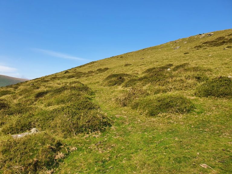
From the car park, referred to above, head North straight up the hill. Don’t be tempted to take the obvious path to the left. This joins up with the golden road but will not help on this walk.
You can get to the site by going straight up over the top, but the path steepens and then gets quite boggy as it flattens out again. Do this if you wish by picking up the track heading North on the top.
We prefer to take a left (North West) at this point (about ¼ of a mile from the parking area) onto a just visible sheep track in order to skirt around the mountain.
The path becomes easier to see as you do so.
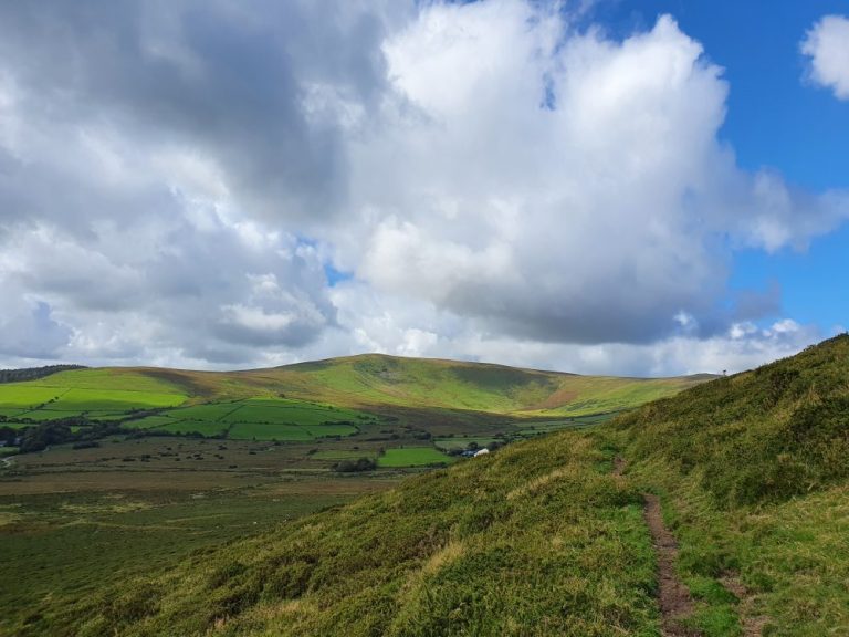
Follow it for approximately ½ a mile until you get to these rocks. Shortly after these the path forks. In order to get up to the Preseli Hills Crash Site you need to take the one to the right and head North East towards the rocks you can see above you to the right.
When you get just above them, you’ll just about be able to make out the cross up ahead and slightly to the right or just to the South East.
Head for this and you’ll see the bare ground and the plaque.
Facilities
There are no facilities here so be prepared. The nearby village of Maenclochog has:
Public Conveniences
A well stocked shop
Petrol Stations, and
A Cafe
Thoughts
Do not be fooled into thinking you can head up here without the right gear. This is a Welsh mountain and when that mist comes in (and it does even on the brightest, hottest days) you will completely lose sight of any markers or paths in the distance.
If you’re lucky, you may get to make a few friends along the way.
If you are visiting Pembrokeshire now or in the near future please be aware that social distancing rules still apply in Wales. Please keep yourselves and others safe.
I love this! I am a huge WWII history buff (not expert, just enjoy learning things!), so this is fascinating to me. Thanks so much for sharing such great details for those who may want to go visit!
What a wonderfully detailed guide for finding the Preseli Hills Crash Site. Very helpful for people trying to find the right spot. And those horses along the way are beautiful!
Wow. I’m glad there is something there to commemorate the loss of lives. But how did you find out about this? Is it pretty well known in Wales? It looks like it was a beautiful day when you visited.
Thanks Lannie. No it’s not really well known other than by some people locally and the families. We knew it was there because we’d just stumbled across on a previous hike. It was a bit surreal.
Tragic event but somehow I’m reality excited by WWII sites like this. It’s definitely the most interesting part of modern history. Sounds a challenge to find but definitely some good pointers here. I wouldn’t mind that wet ground though.
Thanks John. A tragedy for sure. So sad. In a way I’m glad we found it as it brings home the reality of how things really were then and ensure we don’t forget.
Well described….thanks for this 🙂 …we stumbled across this site whilst I was running away from a herd of mountain ponies (I’m a baby & scared of them) but I will agree they are friendly & lovely to see…We returned today to place a little poppy in remembrance of those who lost their lives on that fateful night ..19/09/1944…..RIP.


13 thoughts on “Preseli Hills Crash Site”
I love this! I am a huge WWII history buff (not expert, just enjoy learning things!), so this is fascinating to me. Thanks so much for sharing such great details for those who may want to go visit!
Thank you Jenny 🤗. Your kind comments have made us glad we wrote it!
Beautiful views and a sad crash site. It’s pretty mind-blowing that grass can’t grow there now.
Thanks Francesca. Yes incredible views up there and very, very sad. The bare patch is how we first stumbled across it. Stands out from a way off!
What a wonderfully detailed guide for finding the Preseli Hills Crash Site. Very helpful for people trying to find the right spot. And those horses along the way are beautiful!
Thanks Becky! Yes we were lucky to see them on that day as they’re a bit shy!
Wow. I’m glad there is something there to commemorate the loss of lives. But how did you find out about this? Is it pretty well known in Wales? It looks like it was a beautiful day when you visited.
Thanks Lannie. No it’s not really well known other than by some people locally and the families. We knew it was there because we’d just stumbled across on a previous hike. It was a bit surreal.
So nice to read this post! And a very nice remembrance for the men who lost their lives that night. Looks like a lovely hike and beautiful photos 😀👏
Thanks so much Cindi. Much appreciated 🤗
Tragic event but somehow I’m reality excited by WWII sites like this. It’s definitely the most interesting part of modern history. Sounds a challenge to find but definitely some good pointers here. I wouldn’t mind that wet ground though.
Thanks John. A tragedy for sure. So sad. In a way I’m glad we found it as it brings home the reality of how things really were then and ensure we don’t forget.
Well described….thanks for this 🙂 …we stumbled across this site whilst I was running away from a herd of mountain ponies (I’m a baby & scared of them) but I will agree they are friendly & lovely to see…We returned today to place a little poppy in remembrance of those who lost their lives on that fateful night ..19/09/1944…..RIP.